Puueo Farm Lots Association
To get the originals of the pictures below, right click on the picture and specify where you want to store it using ‘Save link as…”
This image is made of many aerial photographs taken in the early 1980. The planned Puueo Farm Lots lot boundaries and lot numbers are drawn on the composite photograph.
The actual subdivision map shows extreme detail, but had to be divided into two sections to fit nicely on a normal sheet of paper.
The above section shows the upper part of the Puueo Farm Lots in extreme detail
This is the lower part of the Puueo Farm Lots.
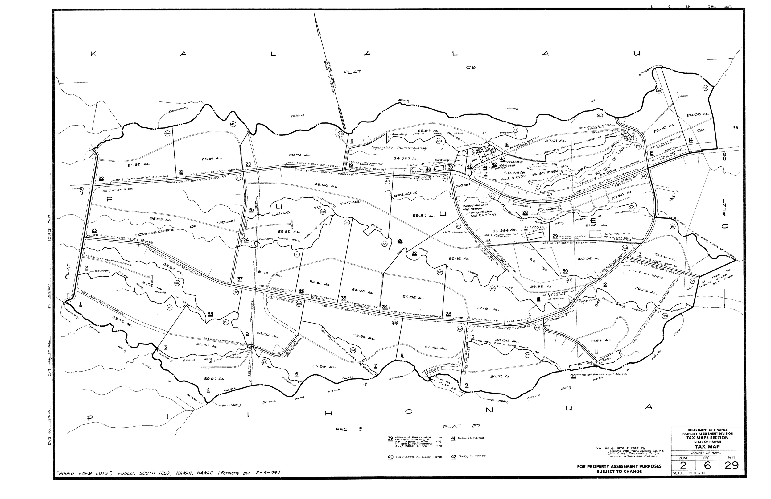
Here are the TMK maps for the two sections
This is the part of a USGS map that shows the Puueo Farm lots.


